Captain's Quarters

After 1,318 days of living on the road, I have signed a lease for an apartment!  No more mornings spent packing up my backpack before checkout time.  No more afternoons spent wondering where I would sleep later that evening.  I have a home, for now.

For the last 4 years, without the daily responsibility of a job or the fiscal obligation of rent, I’ve been free to embark on some amazing adventures – sailing across the South Pacific Ocean, volunteering in Chile and Thailand, and exploring various coffee shops, public libraries, and friends’ living rooms in search of free WiFi.  

I’ve also been free to invest the time required to launch a new career as a Sailing Instructor, Yacht Deliverer, and Charter Skipper.   

As you recall, in 2015 I set out to “chart a new course.” Since then, things have worked out quite well, perhaps even better than I expected.   

Looking ahead in 2019, with no extended travel in the foreseeable future and with steady work at OCSC Sailing School, I will be in the San Francisco Bay Area for an indefinite amount of time.   

With the scales of international travel versus domestic living tipping back in favor of domestic living, it makes more sense to have a home base for the near term. (Previously, with a much higher percentage of my time spent abroad, living rent-free made the most economic sense.)

So, I found and leased a little apartment in San Carlos, the City of Good Living, for 2019. It’s walking distance to downtown and just a mile from my house (which remains rented). 

After living out of a backpack, a laptop bag, and a gear bag for four years (~5 cubic feet), I had mixed feelings as the contents of my 10x20 storage unit (~1,200 cubic feet) burst into the closets and corners of the 1-bedroom apartment.  It was great to spread out … but, my oh my, where did I get all this STUFF?

Marie Kondo, please save me!  Spring cleaning is ahead, and will certainly continue into the summer, as I try to purge a lot of what I have easily lived without (and not even really thought about) for 1,318 days.

That said, I’m already enjoying the quiet space that I can call home, the same home, every night. My familiar couch.  A home-cooked meal.  No check-out time.

Apart from purging, I did make one other promise to myself:  Dannyboy still travels…   (I just may not be gone for months at a time, at least not in 2019.)

Very strange. I bought a vacuum cleaner.

On Cruise Control

After the excitement of receiving my U.S. Coast Guard Master’s License in early February, I haven’t had a lot of new news to report lately.

I’ve been working at OCSC Sailing as much as possible, enjoying the diverse challenges of winter sailing: from constant rain to sudden squalls, from 180-degree wind shifts to no wind whatsoever. It’s kept my students and me on our toes, for sure.

Off the water, I’ve been trying to manage my accommodation expenses by rotating evenings on sailboats, hotels, and friends’ houses. I’m staying on my budget, but with no extended travel on the horizon, the benefits of being a vagabond are dwindling.

Recall, one of the major benefits of my living situation is that when I travel abroad for an extended period of time, I am not burdened by rent payments back home in the San Francisco Bay Area. I just pay for local hotels or apartments while traveling - and usually my travel destinations have very inexpensive housing. The trade off is that I have to find hotels in the expensive Bay Area when I am home. So the more time I spend in the Bay Area, the less favorable my living situation becomes. More on this in a later post.

The month of March did bring two newsworthy events.

First, after a lot of studying as well as on-the-water practice, I took the U.S. Sailing Cruising Instructor evaluation… and passed! The intensive course involved a 3-day, 2-night passage around the San Francisco Bay, with 3 other candidates and 1 instructor. We sailed day and night, we anchored and moored, we cooked and cleaned, and we executed close-quarter and crew-overboard maneuvers. It was a challenging course, but well worth it. Earning the certification now enables me to broaden my teaching curriculum – I can now teach on the bigger 36+ foot cruising boats. The syllabus includes boat systems, anchoring, mooring, etc.

The timing is perfect, because as March comes to an end, we approach the beginning of the sailing season on the San Francisco Bay. I look forward to a full spring, summer, and fall of teaching classes! I may sneak away for a few short adventures abroad - so stay tuned. Otherwise, I’ll be on “cruise control” working at OCSC Sailing with my expanded scope.

And the second newsworthy event? I turned 50. Enough said. :-)

Cruising around the San Francisco Bay for 3 days, 2 nights, as I was being evaluated (and eventually certified) as U.S. Sailing Cruising Instructor!

Mission Accomplished!

It’s official! I’ve earned my Merchant Mariner Credential, and have been licensed by the U.S. Coast Guard as a Master (Captain) for vessels up to 50-tons.  

Here is my sailing story:

In 2013, confined in an office cubicle, I daydreamed of sailing on the San Francisco Bay.  As luck would have it, a friend and co-worker of mine bought a boat, and he invited me to sail with him in weekly “beer-can” races.  I was thrilled.  

At the end of the season, I enrolled in sailing classes at OCSC Sailing in Berkeley, California.  Always a good student, I took learning seriously. I sailed on the weekends and studied on the weeknights.  I even built a small-scale model of sailboat out of wood, string, and wire.  I set it up on my dining room table, which was certainly not being used for dining, and practiced tasks like reefing sails and recovering crew overboard.

Within a few months, I had passed the written exams and the on-the-water evaluations, and was certified by U.S. Sailing as Basic Cruising Skipper.  I was approved to take J24 keelboats out into the Bay!  I sailed as much as possible, with friends brave enough to join me on the wet, wild ride around the Bay. 

In 2014, I earned my U.S. Sailing Bareboat Skipper certification, enabling me to charter the large, comfortable “cruising” boats.  These boats are typically 36- to 40-feet in length, complete with galley, salon, head, and cabins. It was much easier to enlist friends for day or night excursions to Angel Island, Alcatraz Island, Golden Gate Bridge, and Pier 1.5 / Ferry Building since these boats offer more protection from the elements than the sporty J24 keelboats.

By 2015, I realized just how much I enjoyed sailing.  Not only did I enjoy sailing, I wanted to make a career out of it!  I envisioned skippering charters, delivering yachts, and teaching students.  

To do this (and get paid for it), I needed to get a U.S. Coast Guard-issued Merchant Mariner Credential, with a Master rating… more commonly known as a Captain’s License.  

The license requires passing as series of exams covering a massive amount of material ranging from rules of the road to deck safety to navigation to general deck stuff.  But that’s almost considered the “easy” part.  

The harder part is accumulating (and recording) the sea service required, which is 360 days on the water.  A “day” is defined as 4 hours underway.  The challenging part is that an 8-hour or even 24-hour day (like in an ocean-crossing) is still only 1 day of service.  

Ugh.  Even if I sailed one day every weekend, for an entire year, it would take over 7 years to accumulate the required 360 days.  I had to get sailing!  

To accelerate my accumulation of sailing days, I needed to broaden my capabilities, and expand beyond just San Francisco Bay.  

I headed back to OCSC Sailing and enrolled in their Coastal Navigation and Coastal Passage-Making (CPM) courses. Coastal Navigation involved a lot of classroom time (and homework), as we worked on paper charts and solved navigational questions.  The CPM course, on the other hand, required a week-long training sail along the California Coast and in/out of the San Francisco Bay.  I left these courses with my next U.S. Sailing certification, Coastal Skipper, and as it turned out, with a great friend and mentor, Tom Prior. 

To further accelerate my accumulation of sailing days, I simply needed more time and flexibility. 

So, in 2015, I made two significant changes to my lifestyle in order to focus on sailing.  I quit my job in financial planning and I rented out my 3-bedroom house in San Carlos.  Relieved from these daily obligations, I was free to spend as much time as needed – and go wherever I needed to go – to get the experience required to qualify for my Captain’s License.

At the same time, I had to be careful not to let my care-free lifestyle get out of control. Without a daily routine, I could easily slip into full-time slacker mode.

I built a budget, set goals, worked hard, and stayed focused. 

Over the next three years, I sailed whenever I could.  I chartered boats in Croatia twice, sailed across the South Pacific Ocean five times, and even began working at OCSC Sailing as a Sailing Instructor.  When there wasn’t much sailing to do, I headed to foreign countries like Chile and Thailand to volunteer in exchange for housing as a way to preserve my budget for the next sailing opportunity.

My sailing days accumulated faster and faster.  I switched over from manually recording days in my paper logbook to actually using an Excel spreadsheet.  I modelled out the weeks, months, and years, and set a goal to reach 360 by the end of calendar year 2018.

In mid-2018, as the achievement of my goal was in sight, I flew to Portland, Oregon, for a 10-day class at Columbia Pacific Maritime, which helped me prepare me for the 7 exams.  I took the exams and passed them all, including the sailing endorsement (of course) and towing endorsement.  

I finally reached 360 days goal near the end of 2018, broken down something like this:

25 days training on the water.

100 days sailing around San Francisco Bay.

150 days working as a Sailing Instructor.

50 days cruising Croatia, New Zealand, and Fiji.

60 days crossing oceans. 

So, just in time to meet my personal deadline, in December 2018 I submitted my application, exam results, and sea service to the U.S. Coast Guard.  Initially delayed by the shutdown, the USCG finally approved my application and issued me a Merchant Mariner Credential with the Master 50-ton Inland + OUPV Coastal rating in February 2019.

What does this mean? The short answer is I can now work as skipper-for-hire.  Passengers can pay me directly.  (Right now, they pay my employer OCSC Sailing who then pays me.)   So, I could buy a boat and take paying passengers out on tours of the San Francisco Bay, California coast, or U.S. Virgin Islands for example.  Or someone could hire to me help them learn to sail on their boat.  

At the beginning, the goal of getting my Captain’s License seemed far away and almost unattainable.  Certainly, quitting my corporate finance job to become a professional sailor was a bit unsettling and scary.  But, my experience and success proves the old saying, “a journey of 1,000 miles begins with a single step.”  You just have to start.

Thanks to everyone at OCSC Sailing for the training and support over the years, to Columbia Pacific Maritime for the help preparing for the U.S. Coast Guard exams, to Kerry Sheehan (SV Windswept Lady) for the invitation to crew on his boat back in 2013, and to Tom Prior (SV Avalon) for the encouragement, opportunity, and trust to sail across oceans.  And thanks to friends and family for sticking with me and not thinking I’m too crazy!

It’s been an amazing few years of untraditional living, unwavering focus, and unmatched personal growth.  The memories are countless, and the adventure continues…

It all began in 2013 with this model of a J24 keelboat made out of wood, string, and wire so that I could practice maneuvers and commands.

Holiday Road Trip

For the Holidays, I embarked on a 3-week road trip north to see family and friends in the Pacific Northwest.

The sailing season in San Francisco is always a bit slower in winter than in summer, so I had plenty of time on my hands. Therefore, I chose to take the slow and scenic route: I drove along the coast both directions, covering about 1,700-miles in total.

On the trip north, I drove at a normal pace, enjoying the curvy roads and ocean views but not making a lot of stops for sightseeing and hiking.

I stopped in Crescent City the first night, avoiding Eureka where I’d been assaulted and robbed on a similar trip in 2016. The second night I arrived in Florence where I stayed with my Uncle and Aunt, and enjoyed fresh crab for dinner.

I then made my way to McMinnville to spend a few days, including Christmas, with my parents and little brother’s family. We busied ourselves with a big dinner, lots of presents, and the usual family games and puzzles.

From McMinnville, I headed into Portland for the weekend and New Year’s Eve. I caught up with friends and enjoyed city living, especially the craft beers and boutique coffee shops, both great solutions for rainy days.

On New Year’s Day, I headed over to the beach and stayed at my family’s beach house. I enjoyed a few beach walks in between rain storms, but mostly I enjoyed the absolute downtime the beach offers. My parents joined me for the last night. We tried (unsuccessfully) to conquer a 1,000-piece jigsaw puzzle in one night! But we made a good effort.

By January 5, it was time for me to head back to San Francisco, but I was going to average only 100 miles per day and take a week to get there! I wanted to do plenty of hiking, but I also wanted to visit as many of the Oregon coast lighthouses as possible. I figured that one day I would be sailing down the coast of Oregon, and maybe I should pay homage to these lighthouses that have provided navigational aid to vessels for over 150 years!

As it turned out, the weather didn’t cooperate much for hiking. Or, better said, I didn’t have the right gear. I had my waterproof jacket and boots, and my ‘water resistant’ pants, and even my trekking poles. But I’d forgotten my hardcore waterproof pants. I still ventured out on some of the less-rainy days, but it was just too wet most days for any kind of extended multi-hour hike.

I did manage to visit nearly all of the lighthouses on the Oregon Coast! A couple were closed or inaccessible to the public, and one was north, not south, of my starting point, but here are the ones I did visit: Cape Meares, Yaquina Bay, Heceta Head, Umpqua River, Coquille River, and Cape Blanco. I also stopped by the lighthouse at Point Arena in California.

The “lighthouse tour” was a great way to add purpose to my road trip, rather than just sort of randomly poke along (although that is fun too). Admittedly, I did do my fair share of random roadside stops for pictures, hikes, and whale-watching. Unfortunately, I didn’t see any whales. The fog, rain, and wind didn’t help viewing. It’s certainly possibly that some of the frothy spray from whitecaps was actually a whale spout.

Apart from the lighthouses and coastal views, the other highlight was driving through the Redwood forests featured in Prairie Creek Redwoods State Park and Humboldt Redwoods State Park. In particular, I took the scenic detour along Avenue of the Giants — a fantastic 31-mile drive with plenty of stops for short hikes.

Only on the last day of the road trip, coming down through Stinson beach, did the sun finally come out. It was a glorious approach into San Francisco, emerging from the Robin Williams Tunnel and seeing the Golden Gate Bridge, Alcatraz, the city skyline, and of course the bay itself, where I’ll spend so much time this year teaching sailing.

After three weeks, 1,700 miles, and a lot of different beds, I thought “Wow, it’s great to be home!” But then I realized I wasn’t really going home: I needed to find a hotel for the night…

Beach walk at manzanita beach, oregon.

beach walk at gold beach, oregon.

cape meares lighthouse, oregon.

yaquina bay lighthouse, oregon.

heceta lighthouse, oregon.

heceta lighthouse, oregon.

umpqua river lighthouse, oregon.

inside the first order fresnel lens at umpqua river lighthouse.

coquille river lighthouse, oregon.

cape blanco lighthouse, oregon.

point arena lighthouse, california.

at the top of cape blanco lighthouse.

driving through the redwood forests! look at the size of that tree vs. my car! (this photo was taken along a small road that is an offshoot from “avenue of the giants,” which itself is a 31-mile scenic route paralleling highway 101.)

Not the best picture of me, but here I am on a short walk through the Redwood Forest. It was great to visit during the offseason because there was no one on the trail! Quiet and peaceful!

House-Sitter for Hire

Well, ok not for hire… I’ll do it for free!

You see, my house in San Carlos is rented through September 2019, and possibly beyond that. So I continue to be homeless, even when I’m “home” in the Bay Area.

Upon returning from New Zealand, I was grateful that my friends (who happened to be in New Zealand traveling for a month) offered to let me house-sit for them at their house in Orinda.

While some folks in the Bay Area frown at “East Bay,” but I don’t mind the location at all. In some ways, I prefer it, since that’s where my sailing club and part-time employer, OSCS Sailing, is located. I have more and more friends moving to East Bay because of its affordability. Well, at least more affordable than many City or Silicon Valley neighborhoods.

While house-sitting, I mostly took care of long-overdue administrative tasks, like transferring photos and videos from camera to computer, and then backing up my computer to both online and external hard drive storage.

I had a stack of mail to go through, having been gone for 7 weeks, but as usual about 95% of it was junk mail. What a waste of paper and human resources.

I also did a few things for my friends who own the house. I climbed on top of the roof and cleaned out the rain gutters, which were full of leaves and dirt. Dirt, you ask? Yes, I think so. But it also could have been ash from the recent California wildfires.

I also played Santa, wrapping a few last-minute Amazon orders from the parents so that, upon return at the end of December, the kids would see the real Santa hadn’t forgotten to visit their house.

Lastly, I took care of the mail and garbage, too, like any good house-sitter.

The family (as well as my parents) read this journal, so I’ll leave out the details of the wild parties I hosted at the East Bay estate… :-)

In any event, it was great to have a house to call home for a few weeks. Thanks to A, M, B, and J!

I don’t have housing lined up yet for any of 2019. I’ll be in the Bay Area for Jan-Feb and Apr-Sep, so if anyone needs a house-sitter during those times, please let me know! (Unfortunately, with my Sailing Instructor schedule, I can’t offer to do daytime dog-walking.) Thanks!

Although I didn’t teach any sailing classes, I did take the J24 sailboat out a few times for some winter sailing.

Sailing gear came in handy while cleaning gutters. Gloves to protect my hands from sharp metal edges. Safety line to prevent the trowel from falling off the roof. Unfortunately, no safety line for me…

A lot of dirt, and ash (?), in the gutters.

Auckland Once Again

After spending a week exploring the Central Plateau and taking some great hikes around volcanoes, lakes, rivers, and waterfalls, I headed back to Auckland on November 30.

I wouldn’t fly home to the U.S. until December 6, so I had some time to just relax in this vibrant city. I’ve stayed in the “City of Sails” several times before as part of my adventures on SV Avalon, so the pressure of sightseeing and souvenir shopping was nonexistent. I simply booked a nice hotel room for a couple of nights (the Stamford Hotel), and then an apartment (Star Victoria Serviced Apartments) for another few nights.

I spent the days sipping coffee, sorting through photos and videos, and doing lots of laundry. The apartment had a washer/dryer. I also visited many of my favorite establishments: restaurants like Farina, Monsoon Poon, Kebab Time, and the Asian food mecca Food Alley; bars like Lime, Fiddlers, and Swashbucklers; and cafes like VicPark Café and Good Times Coffee.

Coincidentally, friends from San Francisco arrived in Auckland during this time, so I crashed their family vacation and joined them for a morning walk around the Wynyard Quarter. I also met up with a local friend Tim, who I’d met on a previous visit. He’d given me suggestions for the Central Plateau, so it was great to be able to thank him in person.

December 6 came pretty quick. I packed my bags securely for the long flight home, and took a final InterCity Bus ride to the airport. I arrived plenty early and took advantage of the lounge access I know get with my Priority Pass (thanks to my upgrade from Chase Preferred to Chase Reserve credit card). Totally worth it! I was even able to get Skipper Tom in as a guest.

The flight home was smooth, although it’s always weird flying home to San Francisco from Auckland. Due to the international dateline, the flight typically lands before it takes off!

I’d been gone for 7 weeks. It was nice to be back in the Bay Area.

Upon arrival, I took a Lyft ride to my house to retrieve my car, and then drove to my storage unit for a quick gear change. I then drove across the bay to Orinda, in East Bay, where I would house sit for the rest of December. The house actually belongs to the friends that I’d rendezvoused with in Auckland! While they rent a camper van and drive around South Island, New Zealand, I’ll be recovering from my trip to New Zealand in their house. It’s a great (and low-budget) way to close out the year.

Happy to be back in the vibrant and familiar City of Sails, Auckland!

Sky City tower lit up for the Holidays.

Star Victoria Serviced Apartments - very comfortable with lots of amenities, in particular a washer/dryer for this weary traveler.

My second apartment was equally nice… a coveted corner unit with lots of windows and balcony!

Hobbit for a Day

My last stop before Auckland was Rotorua, where I would spend two nights. My main objective was to use Rotorua as a base for getting to Hobbiton (Lord of the Rings fame). But during my visit, I realized Rotorua has several cool attractions of its own.

My accommodation Aura was centrally located with super friendly, very helpful staff. Unfortunately, the room itself was a bit disappointing because of the lack of air conditioning and the lack of plugs. I only found three plugs: one in the kitchen that didn’t work, one in the closet that wasn’t convenient, and one near the bed about 4 feet off the floor (which was also not very convenient for my laptop plug, which kept falling out of the socket). There wasn’t even a plug in the bathroom.

The first day, I had a late lunch at BREW on “Eat Street” – a short pedestrian block that has lots of trendy eateries. I had a great fried chicken sandwich (with bacon, cheese, coleslaw, and jalapenos) and a local Croucher beer.

After that filling lunch, I had to get some exercise. I walked about an hour through the Government Gardens, along Sulfur Point, and up to the Whakarewarewa Forest. The forest was very nice with an interesting history dating back to 1901 when it was established as an experiment to study the suitability of both native and exotic species for commercial planting (and I presume harvesting). I had a nice walk along the towering Redwoods and ferns. I even found a Frisbee golf course!

I found myself (as planned) at the local iSite on Long Mile Road, which is also the location of the popular Redwoods Treewalk which consists of over 25 suspension bridges and platforms that wind through the forest, about 10 meters off the ground. I got there at dusk and walked once around; then they turned on the hanging lanterns and I walked around again in the dark. Very cool, albeit quite crowded with tourists. The iSite location is open until 10pm, and they were nice enough to order me a taxi back to my hotel. It’s not safe to walk in Rotorua at night, I hear.

The next day was the “main event”: I had scheduled a tour of Hobbiton, the famous movie set for Lord of the Rings and The Hobbit movies. The bus left at 8:00am and we made the hour drive to Matamata and up to the family farm where the movie set is located.

Hobbiton is very neat and well maintained. The actual tour, however, felt rushed; and it was definitely crowded. Our group was herded along like cattle, just so the next group could follow. The “move-along” nature of the tour made it difficult for everyone to get the pictures (group and/or selfie) they wanted. Our tour guide said that on peak days, they host over 3,500 tourists through the site.

At the end of the tour, we all got a free beer at the Dragon Inn which was built in Hobbiton after the movie was released. (The actual movie scenes of the Dragon Inn were filmed at a studio.) Now the Dragon Inn (as well as other parts of Hobbiton) are used for exclusive private events.

The tour company (“Hobbiton Movie Set Tours”) is very well organized, and I recommend the company. The bus ride was entertaining thanks to our driver’s jokes and stories, and the Lord of the Rings video clips. Again, my only disappointment was just feeling rushed through the actual site.

That night, I had a great dinner at Mexican Cantina Zapata. I met the family next to me – the wife (and her mother who was visiting) are from Puerto Montt, Chile! Small world… since I’ve spent a lot of time on Isla Tenglo, just off the coast of Puerto Montt. After dinner, I strolled through the Thursday Night Market (only once a week so plan accordingly!). The market offers arts and crafts, music, and local food from kiosks and food trucks.

The following day, it was pouring rain. I cancelled my intended hike, and just took a short walk through Kuirau Park, famous for its vigorous geothermal activity. The cloudy, rainy day made the conditions extra scenic and eerie. I made a short iPhone movie that can be found on InstaGram.

Toward the end of my walk, it started raining hard! I hunkered down below a large tree and waited out the storm. After 30 minutes, the rain lightened up a bit, and I made a run for town. After scoping out places for lunch, I couldn’t decide, so I just picked Lime Café next door to Aura. It was bad: no WIFI, no red wine, and no mention of the pizza specials that weren’t on the menu (but on the specials board which I couldn’t see from my seat).

I checked out of my hotel and headed to the bus stop, which happened to be located in front of the iSite tourist office. I caught up on email using the free WIFI and bought a couple of souvenirs. Then I boarded my bus for the 3 hour trip to Auckland…

Whakarewarewa forest.

redwoods treewalk.

lanterns on the redwoods treewalk.

taking another lap along the suspension bridges at the redwoods treewalk… this time at dusk.

hobbiton!

The famous hobbit hole of bilbo baggins. the large tree at the top of the picture is fake! peter jackson requested this perfectly shaped tree be “built” for the movie. it looks so real! All 200,000 leaves were wired on one by one…

bridge and mill as viewed from the lawn in front of the dragon inn.

hobbit home.

A misty day at kuirau Park, noted for its geothermal activity.

boardwalk in kuirau park.

Taupo and Two Hikes

Having spent a week or so in the Central Plateau, and having completed several outstanding hikes, I decided it was time to start heading back north. (And return my rental car!)

The drive from Whakapapa Village to Taupo is very nice. Great scenery, curvy roads, and very little traffic.

I made a couple of short stops on my way to Taupo:

I first stopped at Lake Rotopounamu, where I took a 2-hour walk around the lake. This is a very nice walk through some dense, green forest that comes alive with chirping birds (and in my case dripping rain). There are several short paths from the main trail down to the lakeside shore where you can sit quietly and watch for birds. It was very foggy during my walk; I enjoyed watching the fog roll silently across the lake, too.

My second stop was the famous Huka Falls, where again I took a quick walk. I parked below the Falls and made a 15-minute walk up to the lower part of the Falls. Then I walked back to the car and drove up to the official Visitor Center. I parked, and took a 1 minute hike to the top of the Falls.

The Falls are known not for height but sheer water volume and power. You don’t need a lot of time here, but it’s worth a quick visit for their unique nature. They have a jet boat ride that looks pretty fun, but I’m sure it’s pricey.

After my morning adventures, I drove back to the town of Taupo. I checked into my accommodation, the Suncourt Apartments. My room was very spacious and modern, with a balcony overlooking Lake Taupo.

I returned my rental car to the Budget office (which conveniently was just short walk from the town center). I walked back to the town center, and enjoyed a pulled pork and a beer at Pub ‘N Grub. After lunch, I meandered along the lakeside as I headed back to my apartment.

I had dinner in the adjacent restaurant (Lake Bistro). I opted for the fish and chips, noticing that that’s what several locals were eating. I ate too fast though, as I was trying to get back to my balcony for sunset!

The next morning, I headed to Replete Café for eggs on toast, a coffee, and some WIFI. After noticing the nearby Marmot store was having a huge sale, I resisted the urge to buy a cool Marmot Ares puffy jacket. Instead, I just headed to the bus station where I caught the Intercity bus to Rotorua…

Hiking through the lush forest around Lake Rotopounamu.

Stopping along the beach at Lake Rotopounamu to watch the fog roll in.

Huka Falls, lower section.

Huka Falls, upper section.

Huka Falls in action. Some crazy Kiwi kayakers have gone down the falls…on purpose!

Sunset over Lake Taupo.


Taranaki Falls and Tama Lakes

After completing the Tongariro Alpine Crossing, I left the small town of Turangi, and moved to the even smaller Whakapapa Village. Although the Village is basically located in the Tongariro National Park, you really need a car to get there. I couldn’t find a shuttle or bus service from Turangi or Taupo. So, I ended up renting a car from Taupo, and driving back down to the Village. It was totally worth it though.

I stayed two nights at the Chateau Tongariro, a classic 1920s hotel that offered a nice lounge, restaurant, and cinema, in addition to spacious, lavish rooms. There is an iSite tourist office next door, which can help you arrange transport for the Tongariro Alpine Crossing, or other hikes nearby.

Having completed the Crossing a couple of days earlier, I chose to conquer the Taranaki Falls and Tama Lakes hike combination. The Taranaki Falls is a 2-hour loop, but at the halfway point you can take a 4-hour detour (roundtrip) to the lower and upper Tama Lakes, making a 6-7 hour hike in total, which is what I did.

Starting from the Chateau, I walked to the trailhead of the Taranaki Falls loop. I started on the “lower falls” trail inadvertently, but I ended up liking this route better than starting on the “upper falls” trail. On the “lower falls” trail, I hiked through some dense forest and approached the falls from the bottom – I thought this was pretty cool as I could hear the falls first, and then they emerged before me. (Coming from the “upper falls” trail, I don’t think it would have been as dramatic.)

I took a few pictures and then made the short ascent to the top of the falls. Here, I turned left and began the detour to Tama Lakes. For just under two hours (I think), I followed the trail up and down, over lava flows that are tens of thousands of years old. It’s pretty cool. There is a good view of Mt. Ngauruhoe (Mt. Doom) as well. I arrived at Lower Tama Lake first, and then made the 30-minute ascent to the Upper Tama Lake. Even if you don’t go all the way to the upper lake (it gets a little steep and rocky), you should go part way – because it gives you an even better view of the lower lake. But the viewpoint at the Upper Tama Lake is pretty spectacular.

Coming back down, I followed the trail all the way back to the Taranaki Falls Trail, and then took the “upper falls” trail back to the Chateau.

It was about 15 km again, but there was not as much elevation gain as the Tongariro Alpine Crossing. Once again, though, pay attention to the weather! I started the hike at 8:00am and finished by 2:00pm because the forecast said the afternoon might bring thundershowers. Sure enough, by 2:30pm, it was pouring rain. As I was hiking back down the trail, around 12:00pm or 1:00pm, there were a number of people who were going UP the trail. Clearly, they hadn’t checked (or paid attention to) the weather forecast. I hope they all made it back down!

Obviously the Tongariro Alpine Crossing is the hike to do in the Central Plateau area. But the Taranaki Falls (with or without the Tama Lakes extension) is a good alternative hike if you aren’t able to do the Alpine Crossing due to weather, gear, time, fitness, etc.

The view of Taranaki Falls from the lower part of the trail.

Mt. Doom! (Mt. Ngauruhoe)

Lower Tama Lake (as viewed from about 10 minutes into the hike to Upper Tama Lake).

Lower Tama Lake as viewed from Upper Tama Lake viewpoint.

Upper Tama Lake, as viewed from the Upper Tama Lake viewpoint. Great spot for lunch! But it’s windy!

Hiking back down to my hotel, Chateau Tongariro. (This is actually taken from the short Ridge Trail that is about a 30 minute walk up to a viewpoint. Trailhead is behind the iSite tourist office in Whakapapa Village.)

Tongariro Alpine Crossing

The Tongariro National Park is decorated with a rare dual World Heritage Site status, noted for its Maori cultural and spiritual significance as well as its volcanic and geological features. The Tongariro Alpine Crossing, within the Park, is one of New Zealand’s most famous trails

At 19 kilometers in length, with over 700 meters in elevation gain, through rugged terrain and variable weather, the Tongariro Alpine Crossing trail is not to be taken lightly. In fact, a gentleman died (unknown cause) on the trail the day after I hiked it. Another man died (from exposure / hypothermia) on the trail one month earlier.

So, do your research, come prepared, and know your limits! Many websites and YouTube videos exist online, offering perspectives on how to prepare, what to bring, and what to expect. Here are a few links to get you started:

https://www.backpackerguide.nz/guide-to-the-tongariro-alpine-crossing/

https://wanderlusters.com/preparing-hike-tongariro-alpine-crossing/

https://www.hikingproject.com/trail/7011198/tongariro-alpine-crossing

New Zealand has great tourist information offices called iSites, located in major tourist towns. The iSite locations near Tongariro National Park (e.g., Turangi and Whakapapa Village) are very helpful in providing information about the Alpine Crossing and other hikes.

Again, I strongly encourage you to do your homework, and prepare accordingly.

That said, here are a few notes about my specific experience.

Where to Stay.

The largest city within an hour’s drive of the trailhead is Taupo, which offers a variety of lodging and eating options. I chose to stay a bit closer to the trailhead, in the town of Turangi. I booked the Tongariro Bridge Motel for three nights (see “weather” for more detail about why I did this). The motel had a cozy pub/restaurant as well as laundry facilities. It was a short 10-minute walk to the town center, which had a few more restaurants and a grocery store.

If you have a car, you might consider staying in Whakapapa Village which is even closer to the trailhead. The hotel in the village, Chateau Tongariro, is a classic hotel built in the 1920s, with a nice restaurant, lounge, and even a small cinema! (I actually ended up staying here for a few days after my hike!)

Weather.

For most of us, good weather is crucial for hiking safety. As you are planning your trip, pay careful attention to the weather. This is super important, and not to be taken lightly. You don’t want to be stuck out in the rugged, exposed terrain in big wind, rain, snow, or thunderstorms.

Weather uncertainty is the reason I booked three nights at the Tongariro Bridge Motel. I allowed myself an arrival night of Wednesday, a possible hike day either Thursday or Friday, and then a recovery night of Friday, checking out Saturday morning. As it turned out, I stayed put Thursday, and did the hike Friday – so I needed that extra day.

Here are the best sites for weather:

https://www.metservice.com/mountain/tongariro-national-park.

http://www.myweather2.com/City-Town/New-Zealand/Tongariro-National-Park/14-Day-Forecast.aspx.

I also used some of my sailing apps, like PredictWind.com and Windy.com, as a double- and triple-check.

Also, remember these volcanoes are active – so check for any warnings about volcanic activity.

The local iSite locations (e.g., Turangi and Whakapapa Village) are great resources for current and upcoming weather conditions as well.

Hike Logistics.

The trail is not a loop; it is one-way. Most hikers and tour operators begin at the Mangatepopo car park, and end at the Ketetahi car park. So, if you want to the do the entire one-way crossing, you’ll have to arrange your transport accordingly. Self-parking at either car park is limited to 4 hours, so you can only do that if you’re going to do a partial hike up and back (which certainly some people do).

Fortunately, finding such transport (via shuttle service) is pretty easy because the Alpine Crossing hike is the MAIN local attraction. At the Tongariro Bridge Motel, the front desk arranged for Alpine Shuttle to pick me up at the Motel and take me to the trailhead at Mangatepopo car park. I took the 6:00am pickup, but there was also a 7:30am pickup available. Included in the price ($55 NZD) was a return shuttle ride, leaving the finish line at Ketetahi car park at 3:00pm, 4:00pm, or 5:00pm, depending on when I finished the hike.

Alpine Shuttle was perfectly fine. At both car parks, I noticed several other shuttle services as well. So again, the transport shouldn’t be a problem; just ask at your hotel or iSite for assistance.

Hike Time.

The hike is just over 19 kilometers; guidelines suggest allowing 6-8 hours to complete. With the 6:00am shuttle, I was on the trail at 7:00am. I’m a fast walker, but I also take a lot of pictures. I finished the hike at 2:00pm. In hindsight, I could have spent an extra hour along the hike, soaking in the views, since the first shuttle wasn’t until 3:00pm.

Throughout New Zealand, I found the posted hiking-time estimates were pretty accurate for me. I’m 6’ tall, fit, and a fast walker. In the United States, I’m generally 10-20% faster than posted hiking-times, but in New Zealand I was < 10% faster. So be careful if you tend to be a bit slower. Make sure you allow yourself plenty of time, and be aware that New Zealand hiking-times might be less conservative than in the US.

Hike Characteristics.

As for the hike itself, it’s pretty spectacular. And yes, it’s technical, steep, and difficult in a few places. (Remember, you’re climbing to an altitude of nearly 2000 meters, so oxygen is limited!)

Make sure you are up for the challenge. Do some practice walks at home, or take advantage of the other shorter tracks that are in and around the Tongariro region. I recommend Taranaki Falls Trail, the Tama Lakes Trail, the Tongariro River Trail, and the Rotopounamu Lake Trail. There are many others.

You can read elsewhere online for a thorough walkthrough of the hike. Or watch some YouTube videos like this one: https://www.youtube.com/watch?v=45NKj651UEE&t=627s

From my experience, I think the middle part is the best part. The first couple of hours are basically the ascent to the craters and lakes. The next couple of hours are stunning, as you hike through the craters and along the lakes. There is a “fun” section that is a pretty steep descent down a scree field (loose sand, gravel, and rocks). I sat here, ate a sandwich, and watched people successfully (and unsuccessfully) navigate the path down. Then I took my turn and had some fun! Be careful though! The final couple of hours are, frankly, a bit boring – the view of the valley below is beautiful, but it doesn’t really change for two hours as you follow a well-defined trail down the mountain.

Gear.

In addition to good weather, proper gear is another element to hiking safety. Come prepared! So what does that mean? What do you bring? Again, there are lots of websites that already suggest what to bring. Here is a list of what I brought:

Clothing:

Shoes: North Face low-top hiking shoes (not boots), but they are Gore-tex so waterproof.

Socks: Wool hiking socks from REI

Pants: Mountain Hardwear MT6-U Pant

Underwear: ExOfficio Give-n-Go Sport Boxer Brief

Shirt: Icebreaker wool long sleeve, plus Gill long sleeve zip top

Hats: Fleece cap and baseball cap

Fleece: REI midweight fleece

Outer Layer: Columbia EvaPOURation Jacket

Extra Gear:

Gill sailing gloves (for the chain section)

Oakley sunglasses

Merino wool buff

Sunscreen

Waterproof flashlight (unknown brand)

Greatland rescue laser

Heimdall rescue whistle

25-feet Dyneema line

Extra shirt and socks (dry)

Two apples

Peanut butter packed in Ziploc bag

Mixed nuts, dried fruit, chocolate in Ziploc bag

3 liters of bottled water

Sea to Summit Dry Bags of various sizes to pack above items

REI Flash 18 backpack

Leatherman Charge Multitool

Trail map

Assortment of a few carabiners and buckling straps

Nikon Coolpix AW130

GoPro Hero 3+

iPhone

I ended up not needing a lot of the extra clothes and gear, but that’s the point. Better to have and not need, then need and not have.

Conclusion and “Reconsiderations”

What a fantastic hike! I’m grateful that the weather cooperated; I did my research and planned accordingly. I do have a couple of “reconsiderations.” (I was going to say “regrets” but it’s really hard to have any regrets!) There are two things I might do differently next time. First, I’d like to plan extra time to take the 2-hour detour and make the ascent to Mt. Ngauruhoe (Mt. Doom from Lord of the Rings). Second, I’d probably bring trekking poles to assist in the steep scree descent and to make better time on the flats. All in all though, I’m very pleased and satisfied with the Tongariro Alpine Crossing!

After the first hour or so, looking back down at the trailhead and valley.

In front of Mt. Ngauruhoe (Mt. Doom). Wish I had planned for the extra two-hours to make the ascent! (An optional portion of the Tongariro Alpine Crossing.)

Looking down toward the Emerald Lakes, about the navigate the loose scree field descent!

One of the Emerald Lakes. Look but don’t touch. They are sacred to the Maori.

Another of the Emerald Lakes.

This is looking back across the trail, after passing the Emerald Lakes.

Walking along Blue Lake.

And the descent down to Ketetahi car park. It’s a long windy walk down with a great view.

Tongariro River Trail

After sailing SV Avalon down the eastern coast of New Zealand, from Opua (in Bay of Islands) to Marsden Cove Marina, I bid farewell to the skipper and admiral, and headed south by bus to explore the Central Plateau of the North Island.

The Central Plateau is a heavily volcanic region, with some great hikes through amazing terrain. The most famous of the hikes is the Tongariro Alpine Crossing.

From Marsden Cove Marina, I took a bus down to Auckland, and then another bus toward Lake Taupo. I passed through the town of Taupo, continued along the east side of the large lake, and stopped at the town of Turangi at the southern end of the lake. Here, I stepped off the bus, and checked into the Tongariro Bridge Motel on the edge of town.

That afternoon, I made the short walk to the iSite tourist office in the town center to get information about local hikes, upcoming weather, and specifically, details about the Tongariro Alpine Crossing.

Good weather is a crucial element of a safe and comfortable hike across the Tongariro Alpine Crossing. I had booked three consecutive nights at the Tongariro Bridge Motel, in hopes that one of the days would bring decent weather. (I actually had planned in my itinerary to wait for as long as 5 days for good weather, but I only booked 3 days initially at the motel.) Upon my arrival in Turangi, it was pouring down rain, so I figured I wouldn’t be going immediately.

I waited overnight to see if the weather would improve. The next morning, the forecast update at 6:00am didn’t bring great news. Clear in the morning, but thundershowers in the afternoon. Not good for the Alpine Crossing. I decided to wait.

But, based on the forecast, I had a few hours of nice weather in the morning. The iSite office had suggested the nearby Tongariro River Trail as a good half-day hike. This is a 15-km loop around a section of the river. The walk is mostly flat. I figured it would be a good warmup for the Alpine Crossing. I grabbed some water and snacks, and set out from my motel. (The trail was basically just across the street!)

The trail was well-maintained, well-marked, and easy-going. Highlights include crossing two narrow suspension bridges, and relaxing on a bench watching the fly fishermen. I was slightly disappointed that for a lot of the hike you aren’t actually on (or even in sight of) the river.  

I think this is because the river is famous for fly-fishing.  It’s probably not a good idea for hikers to be stomping by as fishermen are trying to catch elusive trout.  So the River Trail is set back from the river.  Occasionally, there are lightly trodden paths down to the river for the anglers.  

The hike is pleasant enough though, and it started across the street from my motel in Turing.  So it was very convenient.

I completed the walk in a few hours, getting back to my motel before the thundershowers hit. I hunkered down in the restaurant and pub, checking the weather for the next day. It was looking good.

Friday morning I set out on the Tongariro Alpine Crossing…

Setting out on the Tongariro River Trail.

The trail follows the river bank, but a lot of the trail is tucked into the dense trees on either side of the bank.

One of two suspension bridges to cross.

This fly fisherman caught a fish soon after I took this photo. He was excited, and hollered over asking me if I’d caught the catch on film.

Pahia. Opua. Okiato. Russell.

If you find yourself in the Bay of Islands with spare time, I highly recommend this hiking trail. It’s a loop that incorporates a walk along the bay shoreline, two ferry rides, a boardwalk through mangroves, and a rolling stroll through the countryside. It took me about 6-hours, with plenty of stops for photos, but no stop for lunch.

I recommend doing the walk in a counter-clockwise (or anti-clockwise) direction. The signage is more obvious in that direction. I found that out the hard way.

You see, I was trying to rendezvous with some friends who were doing the Pahia to Opua portion of the walk. So I started the walk in a clockwise direction, Opua to Pahia, in hopes of intercepting them. I did meet them, so that part worked out ok. But I continued on the walk, in the clockwise direction, and found myself lost once and confused a couple of times. I had to keep looking behind me at the signs, and try to work backwards where I was going.

So, keep it easy on yourself, and go counter-clockwise. It doesn’t matter where you start.

If you have a map, you’ll quickly see that the ferry sections are Opua to Okiato, and then Russell to Pahia. From Okiato to Russell, you walk through a forest (with some steep sections) and then mangroves (with a boardwalk). From Pahia to Opua, you walk along the shoreline which is quite nice. Just make sure you check the tides; at high tide some parts may be impassable.

If you want to stop for lunch or a beer, I recommend Russell or Pahia as having the best options. Opua has one or two cafes as well. But I didn’t see any options in Okiato. That said, Okiato is the site of New Zealand’s first capital (only for a year in 1840), so take the short detour to that historic hilltop location.

Also, make sure you know the ferry schedules. When I went (early November), the Opua / Okiato ferry ran every 15 minutes or so. The Russell / Pahia ferry ran only every hour. So plan accordingly.

Overall, it’s a great day hike. The track is pretty well maintained. I ran into one section that was slightly overgrown, but not difficult. There are also some steep parts, but if you pace yourself and take your time, it should be manageable for most people.

Funny enough, I did slip on a flat gravel road section. I cut my hand and my knee. So it just goes to show, BE CAREFUL no matter where you are.

Have fun out there!

Part of the walk between Opua and Pahia is right along the coast. Make sure you check the tides! (High tides might make trail impassable.)

Boardwalk through the mangroves.

The little ferry between Pahia and Russell.

Exploring the Bay of Islands

We had arrived in Opua in the middle of the night, in the rain, and in an unfamiliar marina. But, knowing that we were safely docked alongside, I slept like a log. Maybe the celebratory arrival beer helped.

The next morning, the Customs, Immigration, and Bio-Security officials stopped by our boat to check us into New Zealand. Once approved for entry, we departed the Q dock and headed to our temporary slip on H dock in the Opua Marina.

After tying up and tidying up, we headed to the Marina Café for the classic “Big Breakfast” and a beer. We didn’t care it was 9:00 am. We were safely on land after over a week at sea.

Coincidentally, the Opua Cruising Club was hosting “Cruisers’ Week.” We immediately registered. The week involved a tour of the boatyard, presentations by vendors (marine engineers, plumbers, electricians, sail makers, etc.), and an evening dinner cruise aboard a power catamaran to tour local anchorages. More importantly, each day there was at least one event with free food like BBQ burgers, smoked fish, or gourmet pizza. And most importantly, the whole week kicked off with a ‘princess-themed’ party at the Club on our first night after sailing the high seas! So we were ready to party!

So that first night, Saturday night, we created wrap-around skirts from some excess material SV Avalon had on board, and headed to the party. As silly as we thought we looked, we ended up being on the tame side of costumes. Some of the cruisers went all out with dresses, makeup, and other props. It was fun meeting people and hearing their seafaring stories.

For the next week, we participated in the Opua Cruising Club events, and certainly ate our share of food. Nicky departed a couple of days after our arrival. I moved off the boat and booked a room at the Marina Cove Bed & Breakfast for four nights, just a 20-minute walk from the marina. It was great to have a big bed, and one that didn’t roll from side to side. My hosts Mike and Wendy were super welcoming and generous, bringing me fresh bread, fruit, muesli, and yogurt for breakfast… and a bottle of wine for the evening on my private balcony overlooking the Bay of Islands.

One day, I took a long walk from Opua, to Pahia, to Russell, to Okiato, and back to Opua. I’ll write about this in a separate journal entry.

At the end of the week, it was time to say goodbye to Opua and the Bay of Islands, and sail down the coast of New Zealand to our ultimate destination, Marsden Cove Marina.

We made the journey at a relatively leisurely pace. After a short day sail, we anchored at Motuarohia Island (still within the Bay of Islands region) for the first night. We took the dinghy ashore for a quick hike to a great viewpoint. I tried to imagine what it would have been like for Captain James Cook who discovered this island in 1769, when it was inhabited by an estimated 300 Maori people.

The next day, we sailed around Cape Brett and headed south toward Cape Bream, passing the Poor Knights Islands on our port side. Rounding Cape Bream, we waited for two big commercial ships to navigate the narrow channel before we entered.

Rounding another turn or two, we then peeled off to starboard and entered Urquhart’s Bay where we anchored for the night. This enabled us to make the final entry into Marsden Cove Marina in daylight, but more importantly, at the right tidal height and current.

That next morning, we weighed anchor and motored slowly up to Marsden Cove Marina. It was a great feeling to pull into the familiar slip at A dock (after a quick stop at the fuel dock to top off the tanks) where we had started and finished four other ocean crossings in the last two years.

As per tradition, we headed into the Land & Sea Café for a “Big Breakfast” and a flat white. No beer this time. Returning to the boat, we did a series of boat jobs – the most important of mine was to pack up my stuff. I’d be disembarking and taking a bus south for two weeks of exploring New Zealand on land.

In the evening, we made the short walk through the developing neighborhood and checked into the best AirBnB in Marsden, run by hosts Mike and Jennifer. We’ve stayed with them numerous times in the past, and they are always so gracious. Tonight, we enjoyed a dinner of fresh fish and salad, and pavlova for dessert!

After a good night’s sleep, and a lot of internet time to plan my upcoming two weeks, I had a final breakfast at Land & Sea, and then headed to the docks to say goodbye to Tom, Di, and Avalon.

Mike and Jennifer then drove me to the bus stop – which turned out to be a dirt parking lot next to a gas station. I bid farewell to my hosts, and waited for the bus south.

A new adventure was about to begin…

Sailing NC to NZ

As my second week in New Caledonia began, Skipper Tom made the call: The weather looks good for departure!

We checked out of the country, with Tom and Di handling all of the paperwork with Immigration and Customs. After a final sleep on stable land, we cast of the lines and headed south!

We sailed about 60 miles down the coast of New Caledonia, staying between land and the outer reefs, which protected us from the big swells that had been kicked up by several days of constant easterly wind. This was all part of the plan – to let the seas settle a bit as we sailed within the reef’s protection. (Note: The 60 miles is measured as a direct line on the chart. Our actual sailing route was longer due to wind direction and obstacles like reefs and islands!)

When we reached Ile Des Pins, we then headed out through the reef and into the South Pacific Ocean.

As we entered open water, the wind was still fresh and the swells were still big. We had about 24 hours of pretty intense sailing. We were prepared though. We had pre-made simple sandwiches that we could snack on, without any time-consuming (and perhaps seasick-inducing) preparation below deck. We set aside cup-of-soups, too, which is another classic bad-weather staple. We divided ourselves into watches, with two people sleeping and two people sailing. Then we switched every three hours.

The wind and seas began to settle down after that first day in open water. But then it settled down a bit too much -- down to single digits. Meanwhile, the sea state, which generally takes a bit longer to settle down, still rocked the boat with two- to three-meter swells.

These conditions didn’t allow us to sail at a productive speed, so we furled the headsail and turned on the engine. (We kept the mainsail hoisted because it acted as a stabilizer with the swells, helping to minimize rolling.)

Wait. What do I mean by productive speed? I’ll try to explain briefly.

The passage is a bit like a game of dodge ball. At this time of year, low-pressure systems spin out of the Tasman Sea every 5-10 days, passing directly over the cruising route between New Zealand and the islands. These systems bring high winds and rain, and kick up big seas. We don’t want to be in the way!

On these passages, we try to leave just as one low-pressure system is passing over the route. We try “shoot the gap” and make it to New Zealand before the next low-pressure system develops.

So, on average, let’s say we have 7 days to make the 1,000-mile sail south. That’s an average of 144 miles per day, or 6 miles per hour. (For sailing, we do this calculation in nautical miles and knots per hour – but the results are similar enough for illustrative purposes.)

If the conditions are such that we can’t sail at 6 miles per hour, we can drift for a bit or play around with light wind sails, but at some point we have to get moving. We’ll turn on the engine and motor at 6 miles per hour to make sure we are progressing against our overall goal, and staying ahead of the next low-pressure system that will inevitably develop.

Hopefully that gives some context for “productive speed.”

Now, one of the many challenges is we don’t carry enough fuel to simply motor the entire 1,000 miles. Even if we had the fuel, there’s no guarantee the sea state would allow us to motor at that speed. Big seas, in particular, slow us down.

Tom is constantly monitoring our fuel usage (among many other things), balancing making progress toward our destination with saving fuel for emergencies (and, if all goes well, arriving and docking in the marina!).

On this passage, as the wind settled down, we motor-sailed for over three days mid-passage. The calm conditions allowed us to cook some good meals underway, enjoy some sunsets and sunrises, and catch up on sleep.

By the end of the week, the wind picked up again, and we had a couple of days of glorious sailing! Wind was 15 knots just aft of the beam. Seas were down to 1 meter.

As we approached New Zealand, the forecast indicated a low-pressure system moving across our route. It was going to hit us right about the time we’d be approaching our destination Marsden Cove Marina. Not exactly safe conditions for closing the coast, let alone navigating a narrow channel entry.

Marsden was about 100 miles down the coast eastern coast of New Zealand, and it was our intended final destination. However, given the stormy forecast, an alternative was to make landfall sooner. Opua, in the Bay of Islands, at the northern end of the North Island, also handled check-ins. (Before setting foot on land, cruisers have to pass through Customs, Immigration, and Bio-Security checks at designated ports. Opua and Marsden both offered these services.)

After radioing the marina at Opua to confirm availability of a slip and check-in services, Skipper Tom made the decision: For safety’s sake, we’d alter course and head to Opua to wait out the storm.

Don’t get me wrong, though. Opua was no walk in the park either. It was still over 50 miles away, not including the tricky transit through the bay and into the marina. And that storm was still on its way.

We set our course for Bay of Islands, trying to outrace the storm. Just as we entered the Bay of Islands, the wind kicked up to 25 knots and the rain beat down. It was already dark and cloudy. The rain made visibility even worse.

We flipped on the bright deck lights and lit up the boat like a Christmas tree. With all-hands on deck, we go the mainsail down and set ourselves up for landing – dock lines, fenders, flashlights, binoculars, chart of the bay, etc. Then we turned off the decks lights, and let our eyes readjust to “night vision.” We slowed down to 3-4 knots of boat speed, and slowly progressed up the channel.

Our eyes strained in the dark and the rain to identify each red and green channel marker so that we could stay safely in the channel. The marina finally loomed in the distance, marked by specific flashing lights.

And then, just as the clock struck midnight, the Quarantine (Q) dock was in sight. That was where we would tie up, and await Customs, Immigration, and Bio-Security officials in the morning.

Skipper Tom took the wheel and guided us in. As we approached the dock, I stepped off and secured our spring line. Di, Nicky, and Tom worked the other lines and soon enough the boat was secure! We made it! We took off our soaking wet foul weather gear – put to good use tonight – and once in dry, warm clothes, we opened a few beers to celebrate.

Southern France, Like Really Southern

In late October, I headed to France… in the South Pacific. I was actually heading to a small island territory in the Southern Hemisphere called New Caledonia which, per Wikipedia, is a “special collectivity” of France. It helps mark the border of the Coral Sea and the South Pacific Ocean. The plan was to sail SV Avalon from New Caledonia to New Zealand.

Arriving in the capital, Noumea, after nearly 24 hours of travel, I was happy that the “Skipper and Admiral” (otherwise known as Tom and Di, owners of the sailing vessel Avalon) were waiting at the airport for me. The airport is quite far out of town, so it would have been a long, slow bus ride or a very expensive taxi fare to the center. Tom and Di spared me that pain, and even treated me to a welcome lunch at Le Bout du Monde once we reached the marina in Port Moselle.

For the first two nights, I stayed at the Hotel Le Paris in downtown Noumea, which was only a 5-minute walk from Port Moselle. Getting to/from the boat was very convenient. There is also a great multi-tent market with fresh produce, breads, meats, and craft goods open 6 days a week right next to Port Moselle. I enjoyed a few croissants and crepes during my stay.

Soon, however, convenience took a backseat to fun and after the second night I changed hotels to the beachfront Beaurivage Hotel, located along the Baie Des Citrons. Port Moselle was a 30-minute walk from here, but it was a pleasant walk along the waterline. The Beaurivage Hotel also happened to be a block away from beachfront bar MV Lounge, which became my “Cheers” of New Caledonia for the next week.

In the mornings, I’d walk into Port Moselle for breakfast, coffee, and boat jobs. In the afternoon, I’d walk back to Baie Des Citrons. If fact, most days I’d even walk around to the next bay, Anse Vata, to watch the windsurfers for an hour or two. I wondered, should I give it a try? Not this time, I decided.

By late afternoon, I’d walk back to my hotel for a shower and then wander down to the MV Lounge for cocktail hour and sunset. Usually after sunset, I’d meet back up with Tom, Di, and our other crew member Nicky for dinner at one of the local restaurants.

That was it. That was the routine for about a week, as we prepared and provisioned the boat, and watched the weather forecasts waiting for a safe window for the 1,000 mile sail to New Zealand.

It’s hard to explain, but I’m really not in “sightseeing mode” before these passages. I’m focused on helping Tom and Di with whatever they need help with, and keeping myself healthy and fit for the passage.

Back to Bavaria

After spending five weeks exploring the Balkan countries (including two weeks sailing in Croatia), I flew to Munich on Monday, October 1, where I reunited with German friends to hike the Alps and revel in the festivities at Oktoberfest (locally known as “Wiesn”).   

This particular group of German friends has scheduled a “boys’ weekend” hiking trip every year for decades.  Only for the last 10 years or so have my friend Adam and I joined the group regularly.  It’s one of the highlights of my year.

This year, the Bavarian adventure began at the “usual meeting place” – the back corner of the Weinzelt (wine tent) within the Oktoberfest fairgrounds.  It took me about two hours to get there from the airport, including customs, baggage retrieval, two trains, and a short walk… plus some covert operations to store my bag outside the fairgrounds.

After passing through the fairground gates, where security seems to increase every year, I weaved my way through the crowd and found my way to the Weinzelt.  As expected, my Bavarian friend Uli and American friend Adam (who had arrived a day earlier) were waiting for me as I walked in around 8:30pm. Unexpectedly, another friend Isi also showed up. Our three friends from Northern Germany would arrive in Munich in a few days. 

We enjoyed a beer together, but since I was designated driver (and they had been there all day), we called it an early night.  On the way to the car, we played a few of the carnival games testing our arm with the softball throw and our aim with the pellet gun. I drove us home in Uli’s car, enjoying both the stretch of speed-limit-less autobahn between Munich and Berg, and our pitstop for doner kebabs at a local hole-in-the-wall. 

After a good night’s rest, on Tuesday Uli and I headed back to the fairgrounds at 1:30pm per the “Rules of Wiesn”, while Adam stayed home to work. 

Wait.  What are the “Rules of Wiesn”?

Well, over the years, we have developed a set of guidelines, or “Rules,” for enjoying, and surviving, Oktoberfest. 

Some are for fun, like “Don’t buy stuff,” “Don’t pour old beer into new beer,” and “Don’t act like an American.”

But some are serious, like “Save 60 Euro for the taxi ride home” and “Eat.” 

Somewhere in between fun and serious is the rule, “We start at 1:30pm.” 

Why 1:30pm?  The timing usually coincides with the ferry or bus schedule from Uli’s suburban home, and gets us to Wiesn by 3:00pm.  The morning table reservations in the tents are usually done by the time we arrive at 3:00pm; and the evening table reservations start at 5:00pm.  Arriving at 3:00pm enables us to visit our favorite tent Hacker-Pschorr (where a friend works) and eat before we get booted for the upcoming reservations.  

On this particular day, we followed the plan and enjoyed a hendl (1/2 chicken) and a beer at Hacker-Pschorr.   As the reservation time came, we left, and headed to the bar at the Weinzelt.  We met some interesting people, including a couple of tourists from Australia and UK wearing hilariously cheap lederhosen and dirndl – a clear violation of the Wiesn rules.

On Wednesday, we laid low and helped Uli with a few projects around the house.  We also reorganized our bags into smaller overnight backpacks that we would bring with us on our Thursday-to-Sunday hiking trip in the Alps.

As he does every year, Uli planned everything perfectly for this 4-day adventure: transportation, hotel, and hiking route.

On Thursday, Uli, Adam, and I took a bus and then train to Ostbahnhof station. There, as we transferred to another train, we rendezvoused with our friends Ulf, Olaf, and Bernd, who had flown in from Hamburg that morning.  Then all 6 of us boarded another train toward Salzburg, Austria.  Just before the final stop, we disembarked and changed trains, heading to Berchtesgaden.  And then, finally, in Berchtesgaden, we took a taxi to our hotel.  The transfers and rendezvous worked smoothly, again thanks to Uli’s skilled orchestration.

In Berchtesgaden, after checking in to Hotel Boehm, we headed out to dinner in the village.  We enjoyed tasty Schwienshaxe (a roasted pork dish) and then played cards as the heavy meal settled in our stomachs. Our game of choice is “Schwimmen.”

The next day, after a hearty breakfast at the hotel, we grabbed our packs and trekking poles, and walked into the village.  At the far end of the village was the lake Konigssee.  We took a boat across the lake to the trailhead at St. Bartholoma.  Today’s hike was a steep climb up to the Karlingerhaus hut where we spent the night.  It was about 10km distance and 1,200m climb. 

The Karlingerhaus hut was a pretty amazing place, tucked away in a glacial valley with a small lake out front and huge mountains all around.  After welcoming beers on the balcony, we endured very cold showers.  But a hot meal of lentil stew warmed us back up.  We played cards for a while before climbing into our bunks (four to a room) later that evening, well-fed and very tired.

The next day, we met for breakfast in the hut, then embarked on a different route back down to lake Konigssee, which turned out to be a bit longer (15km).  Halfway down, we stopped at another hut, Wasseralm, for a hot vegetable and lentil soup and alcohol-free weissbier. The second half of the hike included a very steep descent (labeled “expert” on the trail map) where we had to use cables (similar to Half Dome, Yosemite, USA) for safety.  But the view was incredible!

We made it down safely, with the last couple of kilometers consisting of a gentle stroll along the valley floor, along lake Obersee, and back to lake Konigssee.  We took the boat across Konigssee, and wandered back down to our hotel in Berchtesgaden (after stopping at a beer garden for another celebratory beer).  We were all very tired, but after showers, we made it back out to the village for another good meal.

On Sunday, we made the journey back to Munich.  Once again, this was coordinated and executed perfectly by Uli.  Another three trains and two buses this time, all with transfers timed to single-digit minutes.  (Including one transfer where maybe we cut it a little close!)

Back at Uli’s house, we cleaned up quickly, donning our best Wiesn attire (for Americans that meant checkered shirts and jeans; for Germans, that meant the full shebang of lederhosen, checkered shirt, vest or sweater, traditional Bavarian shoes and socks).  The taxi came at 2:00pm and we headed to Wiesen.  This was the final day of Wiesn 2018, so we expected quite a crowd.

Fortunately, Uli had made a reservation for us at the Wildstubel tent.  Starting at this smaller tent is somewhat of a tradition for us.  We sit at a U-shaped table that is great for socializing, and welcoming additional guests. In this instance our friends Daniela, Fred, Chris, and Verena also joined us. We had an afternoon of laughs and stories, complemented of course by German folk music in the background, big plates of Schweinebraten in front of us, and cheerful “Prosts” every few minutes.

We were all feeling a bit sore from the hiking, but, as the Rules say, “After the first mass, everything is better.”  As the evening came, we relocated to the Weinzelt for a final round.  Or maybe two rounds.  Then we piled into a taxi for the ride home.

On Monday morning, Ulf, Olaf, and Bernd headed back to northern Germany.  Adam and I stayed at Uli’s until Wednesday, again helping him around the house.  You can imagine we had to do a little cleaning after Uli’s gracious hosting of five guys! 

For our last supper Tuesday night, we enjoyed traditional cuisine of Schauferl and Kaiserschmarrn at the Oskar Maria Graf Stuberl.  On Wednesday morning, Adam and I bid thanks and farewell to Uli, and made the journey home to San Francisco. 

It was going to be a quick turnaround for me. 

Back in the Bay Area, I had six days before my next adventure began.  So, I had to hustle and bustle around town, doing errands and changing gear.  I didn’t get a chance to see many friends unfortunately.   

On October 18, I headed back to SFO with my backpack and sail bag…. Headed to the South Pacific!  Stay tuned!

Ready to go!

The view from Karlingerhaus hut where we spent the night.

Steep descent back into the valley, looking at Obersee and Konigssee lakes in the distance.

Obersee and Konigssee lakes.

Cleaned up and ready for Wiesn (Oktoberfest)!

A few friends joined us for dinner at Wildstubel.

Zoomed-out view of our two-day hike in the Bavarian Alps.

Detail of the elevation gain and length of hike.

One of the toughest parts. A long series of steep switchbacks. Pig’s tail, I think it’s called.

Sailing Croatia 2018 (Week 2)

Hunkered down at the ACI Marina in Slano, we awaited Bora to blow our way.  The forecast called for the notoriously strong northeasterly wind to begin gusting at 2:00pm on Monday afternoon.

The forecast was spot on.   At 2:10pm, Bora arrived. 

I had been enjoying a coffee on the patio at the restaurant in the marina when the server started scrambling to collect the seat cushions and table settings around 1:45pm.  He cautioned me, “You’ll probably want to move inside.” 

“Bora coming?” I asked.

“Yes.”

And literally a few minutes later, the wind increased from 5 knots to 40 knots in the blink of an eye, accompanied by a heavy downpour of rain.

To be fair, dark clouds had been forming all morning.  But that doesn’t necessarily indicate Bora.  Sometimes Bora comes with little or no warning – a clear-air gale, it’s called.  Other times, Bora does bring dark clouds and rain, like today. 

The scene in the marina was intense – some of the most wild wind and rain I’ve ever seen.  I finished my coffee (after moving inside) and then walked down the dock to check on the boat.  Everything seemed to be ok.

For the rest of the day, the skipper of buddy boat “Melanie” and I stayed close to our boats.  Meanwhile, our respective crews went exploring to the nearby town of Ston (known for its wall, its salt factory, and its fresh oysters).  We reviewed the forecast again, and made the easy decision to stay put for another day.  

During the late afternoon, I turned on the boat instruments and captured wind-speed readings of 55 knots!  Fortunately, our boats were tied such that the wind was coming from astern, and blowing us away from the dock, not into the dock!  Our doubled-up dock lines worked just fine.

Sleeping was difficult Monday night, as the wind howled through the marina.  The boat swayed back and forth a bit, but the rock seawall gave us good protection from the choppy waves stirred up by the wind.  

On Tuesday, the gusty wind continued to blow.  Since we didn’t know exactly when we would sail down to Dubrovnik – or how much time we would have there – some of the crew opted to take a bus down to Dubrovnik for the day.  (Although our primary reason for choosing Slano was for the protection it offered, a secondary reason was the accessibility to transportation and services in case we were stuck for multiple days.)

Since I had spent time in Dubrovnik during my 2016 sailing trip in Croatia, I decided to take a hike around the hills surrounding Slano Bay.  Heading south out of town, I walked nervously along a narrow, no-shoulder highway for about a mile.  I managed to find a dirt road that led up into the hills, so I happily followed it away from the highway.  The road led to a small village.  I took a short break in church and cemetery, and then headed back to Slano on a different road … after asking for directions twice! 

After returning to the marina, I met with Melanie’s skipper again to review the weather outlook.  The forecast for Wednesday showed sustained wind of 15-20 knots, but gusts still forecast to be 30-35 knots.  We were only 20 nautical miles from Dubrovnik, but there was no reason to force it.  We didn’t have to be there until Friday.   And the forecast showed much better (i.e., lighter) wind conditions for Thursday and Friday.

I gave the crew the unfortunate news, but they supported the decision to stay put – recognizing it was for our safety.  “Better to be at the dock wishing you were at sea, than being at sea wishing you were at the dock,” as the saying goes.

On Wednesday, two more boats from the OCSC flotilla pulled into Slano.  They had waited out the Bora in Okuklje, a small village on the island of Mljet.  They were well protected from the wind as well; but, as is typical in these villages, they moored at a restaurant-owned mooring spot.  This was great for eating, but the restaurant didn’t offer services like showers and water.  After spending three nights at the mooring and running low on fresh water, both vessels braved the gusts and waves to cross the channel to join us in Slano. 

It was great to see them, and had a good afternoon exchanging stories about the trip thus far.

That evening, Melanie’s skipper and I had yet another forecast review.  We confirmed our plan to depart Thursday morning.  But where to go?

There were a couple of possible anchorages where we could stop for 1 night.  However, my crew in particular had expressed a preference to avoid anchoring, in favor of docking at shore, in order to maximize ability to explore without being dinghy-dependent. 

Thus, Melanie’s skipper and I decided we would sail together directly to Dubrovnik on Thursday.  Arriving a day early would allow people to have a “free” day to do exploring on their own – perhaps even taking a ferry to the National Park on the island of Mljet.  (Recall, we had to scratch Mljet from our sailing itinerary due to the wind conditions.)  Once again, I relayed the decision to my supportive crew.

Thursday morning arrived, and we made prepared the boat for departure – mainly undoing all of the extra lines we’d used to tie things down during Bora.  The wind was light as we slowly motored out of the marina, with buddy boat Melanie following us.  We hoisted the sails, turned to port, and headed south.  We cut the engine and tried to sail a bit, but now the wind was too light!  Such a difference a day makes!

Although our plan had been to stay in the protected channel all the way down to Dubrovnik, the wind was so light (and we had a lot of time), we decided to venture out beyond the first row of islands off the coast, and look for wind in the open Adriatic Sea.

It worked!  And we found perfect wind as we poked out beyond the islands.  We enjoyed an hour of fun sailing, rotating crew around different positions so everyone had a chance to tack the boat a few times and work the jib sheets.

Once we’d had our fill, we continued down south to Old Town Dubrovnik.  We lowered our sails and motored along the city wall, and just in front of the small harbor.   The small harbor was too busy with water taxis and tour boats for us to enter.  We circled in front of Old Town for a few minutes, taking selfies, and then turned around and motored up an inlet just north of Dubrovnik to the Sunsail Marina.

We found our mooring spot right at the marina entrance.  We executed our final Mediterranean-mooring maneuver, and secured Tilly II safely at the dock.  Melanie came in right behind us, and docked alongside.  We opened a few beers and toasted the end of our journey, albeit a day early.

On Friday, the crew set off to explore Old Town Dubrovnik again, while Melanie’s skipper and I relaxed in the cockpit of Melanie and watched all the other charter boats come in.   It was non-stop “Boat TV” all day long.  Boats lined up to enter the marina.  Weary crews lined up to use the showers.  I reflected on the benefit of being one of the first boats in.  There was no line for docking; there was no line for showering.

That evening, back on Tilly II, we packed up our belongings, cleaned up the boat, and got a good night of rest.  We were off the boat at 8:00am the next morning.  I took the bus into Old Town Dubrovnik, where I would spend two days recuperating before heading to Germany for my next adventure.

Overall, the OCSC flotilla was a fantastic trip, with a great group of people.  While the Bora wind caused us to deviate from our sail plan, and even cut our sailing short by a day or two, I learned a lot from the experience, and thank my fellow skippers (especially Melanie’s skipper) and the crew of Tilly II.

Flying the OCSC burgee.

Showing off my “skipper socks” as we make way to Slano.

Doubling up the dock lines in advance of Bora’s arrival.

Nervously awaiting my first Bora…

White caps in the small Slano Bay as wind hits 50 knots.

Ok 55 knots!

View of Slano Bay (marina is just left of center). Beautiful!

Checking the latest wind forecast on Predictwind.com

After waiting 3 days for Bora to subside, we eventually made it to Dubrovnik!

Sailing Croatia 2018 (Week 1)

The adventure began at the Sunsail Agana Marina in the town of Marina, just up the coast from more well-known Split, on Saturday, September 15. About 50 members, employees, and friends of OCSC Sailing gathered in front of the Sunsail office anxious to move onto the chartered sailboats.

We would be 9 boats in total. While the skippers had shared tentative sail plans, we didn’t necessarily plan to follow each other throughout the two weeks, but rather rendezvous periodically at the popular ports.

After checking in with passports and paperwork, the skippers and first mates attended a weather and cruising briefing, while their crews ventured off to do last-minute provisioning.

By late afternoon, we headed to our individual boats for a review of systems, operation, and inventory by a Sunsail representative.

I had chartered a 47-foot monohull – named “Tilly II” – with 4 bedrooms and 4 bathrooms. My crew consisted of two couples and one single gentleman, so we were six in total. The couples took the aft two cabins which were a bit more spacious. The two single guys took the two forward cabins which, by nature of the hull shape, were more narrow. The arrangement worked out great, with plenty of room on the boat.

Other than needing a quick top-off of oil, the boat was good to go, with well-labeled running rigging, straightforward systems, and complete inventory of safety items. The Sunsail representative stepped off, and the boat was ours.

We stowed our gear and provisions, and then sat down for a safety briefing before dinner. The crew patiently endured my review of basic boat safety, daily routine, sail plan, docking techniques, roles and responsibilities, etc. Finally, we adjourned and headed off to a crew dinner.

Unfortunately, dinner was somewhat of a disaster. We went with the “fish special” which included a 1.5 hour wait for our food, a bill that was nearly double what normal entrees would have cost, and a smirking waiter that seems to know exactly what he was doing. The fish, although presented in a big cast iron pan drowning in potatoes, onions, and broth, wasn’t even that good.

After dinner, we retired to our cabins for an early night. We had a big two-week adventure ahead of us!

The next morning (Sunday), we completed final boat preparation and departed smoothly at 9:30am, headed for Milna on the island of Brac. It was roughly 19 nautical miles in sunny, but light wind, conditions. We motored slowly out of the marina and down the Splitski Kanal, getting used to the boat and waking up our sea legs. We hoisted the main sail for good measure, in hopes the wind would materialize.

We did catch a bit of a breeze as we sailed across the gap between the islands of Solta and Brac, which opens southwest to the Adriatic Sea. We hoisted the jib and sailed for about 45 minutes. But as we approached the western edge of Brac, the wind died and we fired up the engine again.

We cruised up the protected channel into the harbor of Milna, where we executed our first stern-to Mediterranean-mooring maneuver at the ACI Marina. It felt good to get one under our belts. We secured and tidied the boat, and then passed cold beers around!

We spent the afternoon exploring the small town of Milna, and then had a fabulous pizza dinner at Slika Pizzeria. The attentive service and affordable menu more than made up for our previous night’s disastrous dinner. We headed back to the boat early again, perhaps all relieved our first “break-in” day was over.

On Monday morning, we departed Milna at 9:30am, and headed 17 nautical miles southwest across the Hvarksi Kanal to Starigrad on the island of Hvar. We docked at the town quay about 12:30pm. One of the other boats in the flotilla, “Melanie,” was planning to follow a similar two-week route as our boat. We quickly became “buddy boats” with Melanie, sharing ideas about weather, routing, activities, etc. not to mention regular radio check-ins for safety and happy hours for socializing.

As we pulled into Starigrad, I radioed Melanie advising on how to find us and that I had asked the dock attendant to save a spot for her. About 30 minutes later, Melanie was moored alongside us. We would spend two nights here.

On Monday evening, our first night in town, we relaxed with a happy hour on the boats. Some of the crew had done an afternoon bike ride (thanks to our early arrival) so they were especially thirsty.

On Tuesday, since we weren’t moving the boat, I took a hike through the vineyards of the 2,000-year-old Starigrad Plain. Then I walked up into the hills, passing by a few small villages, old churches, and ruins. Then back down to the Starigrad Plain and town center. Meanwhile, the crew had taken a bus to the famed Hvar Town. I had a quiet dinner on my own that night at Odisej Restaurant to continue route-planning, weather-forecasting, and journaling. At this point, the weather outlook seemed perfectly pleasant for the next several days - sunshine and light wind. (I was using PredictWind primarily, supplemented by the local forecast from the Croatian site www.meteo.hr)

From Starigrad, we set sail at 8:45am on Wednesday, heading east along the north side of Hvar, and then southwest across the Viski Kanal to the island of Vis – about a 5-hour, 25-nautical-mile transit. We cruised into the bay of Vis Town with Melanie right behind us, and we both docked at the town quay. Soon, a third boat from our flotilla also joined us - an added bonus for socializing.

Our plan was to stay here for two nights, which would allow the crew to disembark and explore the island, known for its military history as well as its vineyards.

From my visit here in 2016, I remembered a very good restaurant called Kod Paveta so I organized a 3-boat dinner at the same restaurant this year for our first night in town. I was greeted by the same great staff (who remembered me!), the same great food, and the same great ambiance.

The next day, Thursday, was a non-sailing day. People split up and pursued a variety of activities. I hiked up the eastern side of the bay and followed the ridge around the bay clockwise, finding panoramic views, old churches, and a few ruins. Seeking a bit of solitude to get some “skipper work” done, I dined at Kod Paveta again. As with each evening, I reviewed the upcoming weather, studied the charts for possible routes and hazards, and wrote some notes about our journey thus far.

As sometimes happens with sailing, changes in the weather forecast can dictate a change to our intended sail plan in order to keep the vessel and crew safe. Occasionally that means the skipper has to make tough calls. And in this case, that’s exactly what happened.

Because we are on a two-week passage (vs. a day sail), we don’t just review the forecast for tomorrow, we review the forecast for the next 3-5 days. (In fact, PredictWind provides a 7-day outlook.) At this point in our trip, the multi-day outlook was showing something concerning: by early next week, as early as Monday, a strong northeasterly wind was expected, and expected to last for a couple of days. This strong wind, locally known as Bora, can blow at gale force (35-55 mph) or higher.

After my solo dinner at Kod Paveta, I met with the skipper of Melanie to exchange thoughts on the forecast and discuss options. Although we were on vacation and wanted to continue our island tour, our primary objective was to get our boats and ourselves safely to Dubrovnik. We reviewed the forecast again and studied the chart, measuring distances and evaluating potential safe harbors.

Our original plan had been to sail from Vis Town to Korcula Town, stopping at the island of Scedero for an overnight to break up the 45 nautical mile trip into two shorter trips. The looming threat of Bora made us question this plan.

Korcula Town (on the island of Korcula) was still nearly 50 nautical miles from our final destination of Dubrovnik. The strong wind expected to begin on Monday and last 2 or 3 days. But what if it lasted a bit longer? The boat was due back in Dubrovnik on Friday, and we did not want to be in the position of being “forced” to sail down to Dubrovnik in unsafe conditions just to meet the deadline.

We wanted to get east, closer to our final destination, while the conditions were safe. We had 3 days (Friday, Saturday, Sunday). We didn’t want to sail on Monday in case the strong Bora wind arrived early. We wanted to be docked somewhere safe by Sunday midday, a full 24 hours before the big gusts. This would give us time to secure the boat - much easier to do in calm wind than in 30 knots of wind. In addition, we knew marinas and moorings would fill up as the storm approached; by getting somewhere early, we’d have a better chance at getting a spot, or finding an alternative if our first choice was full.

All of this led us to the decision to sail straight from Vis Town to Korcula Town on Friday, and not “waste” a day doing an overnight on Scedero. From Korcula Town, we would continue to monitor the forecast and plan our route for Saturday and Sunday.

So, early Friday morning (at 6:15am), we departed from Vis Town and made our way eastward along the Korculanski Kanal. As we approached the channel between Korcula Island and the Poluotok Peljesac, the wind picked up significantly. We hauled our sails in close, and tried to work our way upwind through the narrow channel. The wind was close to the nose, so to help us point, I kept the motor on as well, at a low RPM. We tacked our way through the narrow 6 nautical miles or so, with the walls of Korcula Town drawing nearer, and our buddy boat Melanie following our every tack. As we sailed abeam of the town, we lowered our sails and motored into the marina just to the east of Old Town about 2:30pm. Melanie followed us in.

That evening, we enjoyed another group dinner. We dined at Konoba Aurora, on the waterfront.

On Saturday, another rest day (in terms of not moving the boat), I once again embarked on a long hike. This time I hiked through the rolling foothills behind the town. Others pursued a variety of activities: a military-themed tour, wine-tasting, and boat ride to the Blue Cave on a nearby island.

That evening, my buddy skipper and I reviewed the forecast again to make plans for Sunday. The Bora wind was still predicted for Monday, reaching gale force (35-50 knots) by Monday 2:00pm.

Again, we decided the most prudent action would be to continue east, to seek the shelter and safety of the mainland, skipping the island of Mljet. (Our original plan had included 2 days on Mljet.)

We wanted to get shelter by midday Sunday. The possibility of Bora coming a bit earlier was a risk we didn’t want to take. The mainland offered a safe ACI Marina in Slano Bay, with lots of amenities and excursion options (in case we were stuck there for multiple days).

So, on Sunday morning we departed and headed to Slano. It was another long transit of 35 nautical miles. We departed at 7:30am, and arrived at 1:30pm and docked inside the ACI Marina. It was a little disappointing to sail by Mljet without stopping. We’d had a good time exploring on that island in 2016.

We spent Sunday afternoon tidying and securing the boats in Slano, including: doubling up the stern lines, zipping the main sail stack-pack (or, in Melanie’s case, wrapping it with a spare line since her stack-pack didn’t have a zipper), securing the main halyard so it wouldn’t whip against the mast, cinching closed the forward and aft ends of the stack-pack to prevent reefing line slack from coming out, removing cockpit cushions and stowing below, making sure fenders and dinghy were appropriately placed and secured. We watched other boats arriving later that afternoon and evening, with spaces filling up. Our “arrive early” strategy paid off.

With the boats secure, we had a nice dinner Sunday night at Kolarin Restaurant and waited for Bora to come on Monday….

Our home for the next 2 weeks: a 47-foot sailboat named “Tilly II” with 4 bedrooms, 4 bathrooms, and lots of space for the 6 of us. And WIFI!

Off to a good start, docked at Milna on the island of Brac.

We visited Starigrad on the island of Hvar. I had a great hike through the vineyards.

Wandering around the narrow streets of Starigrad, Hvar.

Obligatory cat photo.

From Hvar, we sailed down to the island of Vis, and docked at the town quay in Vis Town. I had a great hike in the hills above the bay.

We woke up early and departed at sunrise to make the 45-mile transit from Vis to Korcula.

We docked at the ACI Marina in Korcula Town, on the island of Korcula.

Visited the home of a famous Korcula town resident.

After Korcula, we headed to Slano on the mainland, seeking protection from the gale-force wind locally known as Bora.

From Bus to Boat

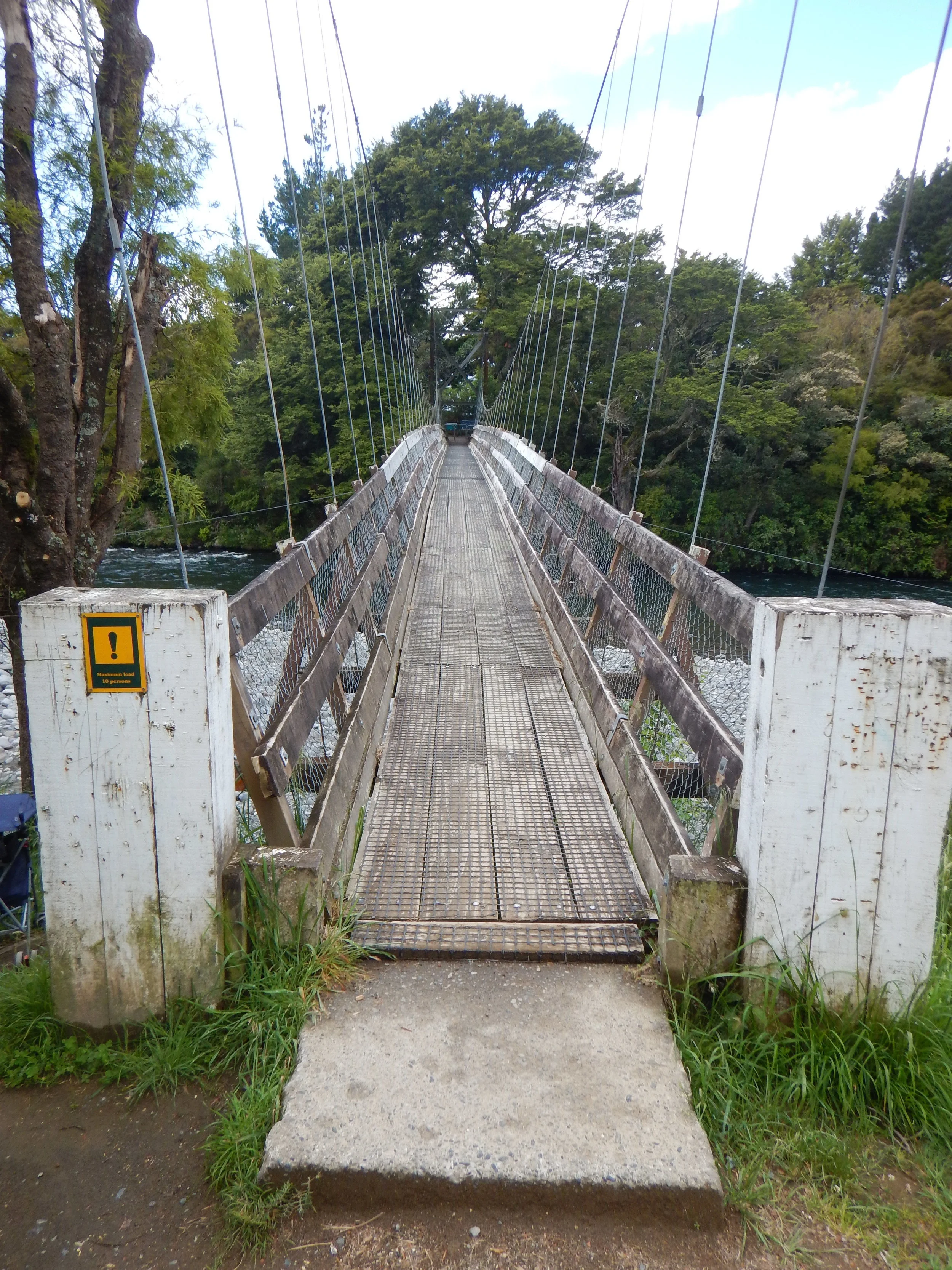
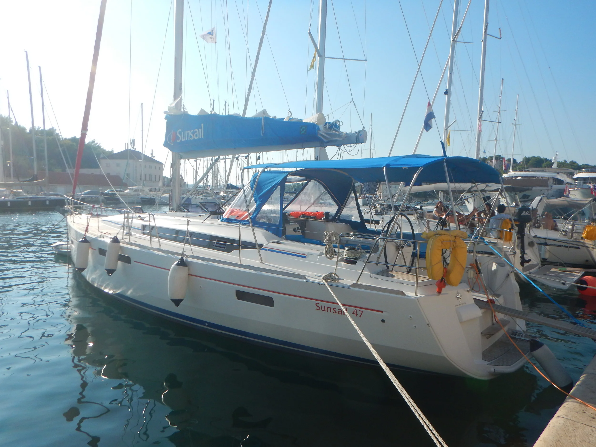
After three weeks of traveling around the Balkan countries by bus, I’m now making the transition to sailboat. For the next two weeks, I’ll be sailing down the Dalmatian Coast in Croatia, from Split to Dubrovnik. I’m skippering a 47-foot monohull with 4 cabins and 4 heads (i.e., 4 bedrooms and 4 bathrooms).

This transition gives me the perfect opportunity to talk a bit about the pros and cons of bus travel, and to offer some tips. I have done a lot of travel by bus, mostly in South America and Europe. While I don’t proclaim to be an expert, I do have a LOT of experience to draw from.

At some point in the near future, when I have good WIFI and time on my hands, I’m going to create a “Travel Tips” section of my website - that’s where a lot of the information below will reside. For now, though, it’s just part of my journal.

As you can probably guess, these days, a sailboat is my preferred vehicle for getting from Point A to Point B. But, if I have to travel over land in a foreign country, going by bus is a pretty good alternative in my opinion.

The biggest advantage of bus travel is the cost: it is CHEAP! At some point I’ll add up the cost-per-mile of my Balkan country tour and publish it. The minimal cost will astound you.

Cost aside, I’m sure you probably think that buses are slow, crowded, and uncomfortable, right?

Well, sure, they can be. But some of these issues can be avoided or minimized, and some can be turned into a positive. Let me explain.

SLOW. Yes, bus travel is slow, but for me that’s part of the enjoyment. Going slow exposes the traveler to a bit more of the local flavor. In most countries, people don’t fly - they take the bus or train. (A lot of the countries I’ve visited just haven’t developed good train systems yet. But I do love trains, maybe more than buses!)

One reason buses are slow is they stop frequently. But look at the bright side — this means your routing can be VERY flexible! You can go from almost anywhere to, well, almost anywhere else!

Buses, because they are slow, give you a chance to catch up on sleeping, managing photos, planning the next leg of your trip, writing in your journal, etc. Just make sure your electronics are fully charged! Even if the bus advertises “AC outlets” and/or “Free WIFI,” there is no guarantee either will work. (This recently happened to me in Serbia. The bus had outlets that didn’t work - and to make matters worse I had forgotten to charge my electronics fully.)

Side note: Some hotels turn off the power to plugs if you don’t leave the room keycard in the slot by the door. So, while you’re at dinner (with the keycard) your electronics aren’t charging. Solution: Ask for a second keycard!

CROWDED. Sometimes buses are crowded. But I try to avoid this by doing a lot of travel in the off-season or edge of the season. Definitely don’t travel at peak. If buses are crowded with locals, use the situation as an opportunity to observe daily life. Who are these people? Where are they going? What are their lives like? If they are tourists, maybe you can strike up a conversation about travel tips, funny stories, hot spots, etc.

UNCOMFORTABLE (PART 1). This is often due to user error. You know it’s going to be a bit uncomfortable, no matter what, so plan accordingly.

Dress comfortably. Just because the bus says “Air-Conditioning” doesn’t guarantee it will be working. Wear loose-fitting clothing; dress in layers.

Use the bathroom before you depart! Like everything else, just because there is a toilet on board (maybe), you can’t assume it works. I was on a bus where the toilet was out of order, and it was a 5 hour bus ride!

Now, on long hauls, the bus will usually stop for 10-20 minutes at a truck stop or restaurant, so people can use the toilet, get some food, smoke a cigarette, etc. BUT, be careful about the definition of long haul. I was recently on a trip from Belgrade to Sarajevo. We left at 4:00pm, and had a toilet break at 5:30pm. Then, we drove straight through until 11:00pm without a break! There was a toilet on board but it didn’t appear to be working… at least no one used it.

Bring a few snacks to nibble on, too, especially if it’s a long haul. Again, there is no guarantee if, when, or where they are going to stop - or what’s offered at the stop.

I always bring a bottle of water with me, despite the aforementioned toilet challenges. I usually bring some kind of cheap ham and cheese sandwich. My latest trick is to bring nuts (I like cashews and almonds). The nuts are healthy, and packed with calories and protein to keep my energy level high.

So stay hydrated, eat something, and just be careful about the toilet use.

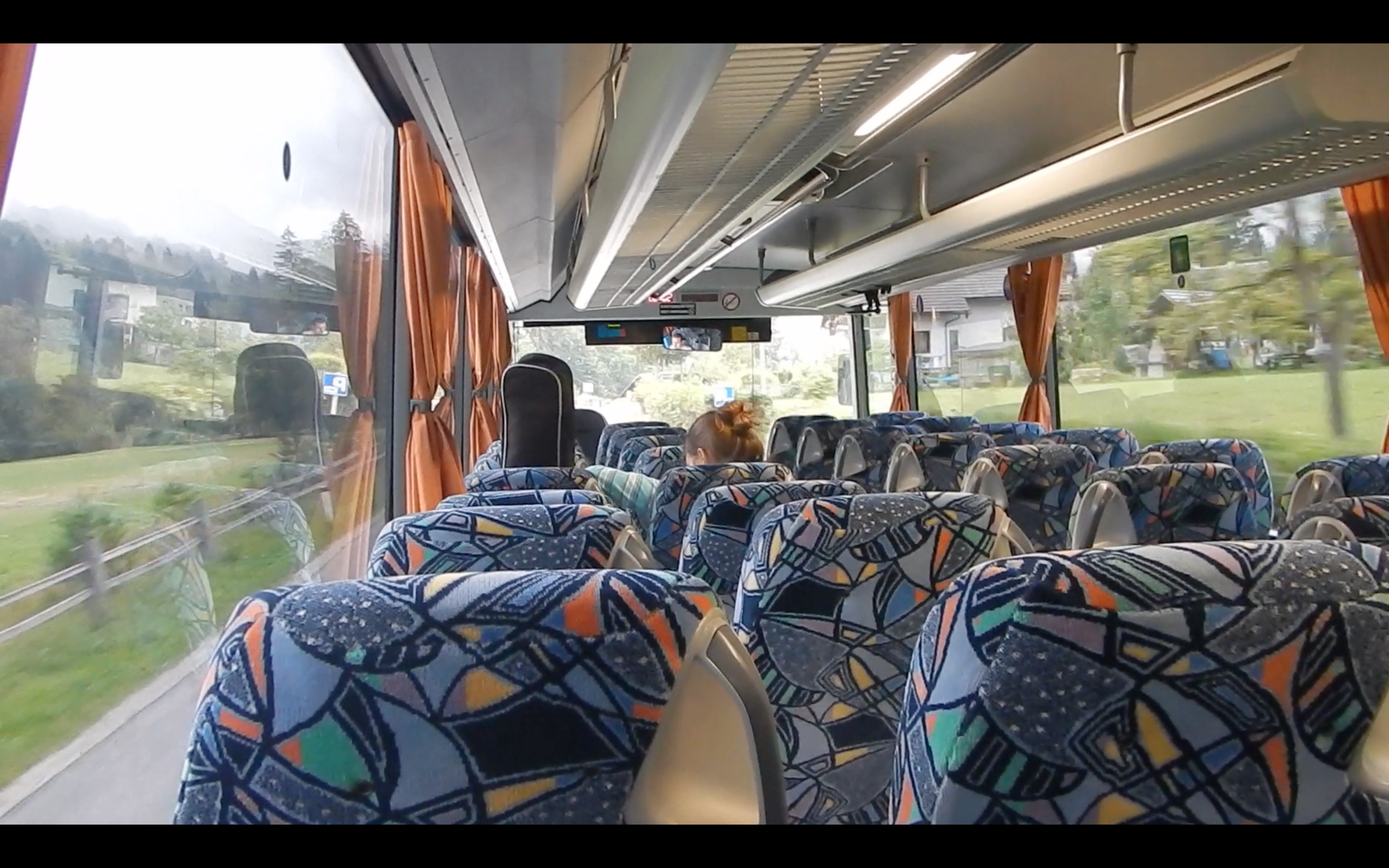
UNCOMFORTABLE, PART 2. Certainly, in some cases, the discomfort is not your fault. There may be some inherent “equipment issue” that makes the bus uncomfortable. Specifically, seating. So let’s talk about seating.

Usually the ticket comes with a seat assignment printed on the ticket. But in my experience, most people ignore this assignment. Get on board and grab a seat you like, whether it’s an aisle or a window, at the front or at the back.

Then check all aspects of your seat.

Is it stable? Once I was on a bus and my seat was because one side of the brackets had come unbolted.

Does it recline? I’ve been on buses where seats don’t recline, or where they stay reclined! (Trust me, staying reclined sounds good, but after 2-3 hours you may want to sit upright.)

Does your self belt work? It may not. Better to have and not need, than need and not have.

Other things to check (but probably bus-wide issues) include: Does your air-conditioning vent work? Do the plug, USB port, headphone jack, overhead light, etc. work?

Now, there are some strategic decisions you can make while choosing your seat.

Check your route - which side of the bus will offer the best view? Which side will be in the sun vs. the shade? Trust me, suns sounds good for about the first 30 minutes, then it’s annoying. If you are on the sunny side, make sure the curtain works. (Again, recently I sat in a seat where the curtain was missing a few rings, so it continually draped down into my face. ) If you plan on taking pictures or watching the scenery, choose a window seat that has a full window view, not next to a support pillar.

Which side of the bus was your luggage stored on? (If I don’t care about the view or sun, I usually try to site on the side where my luggage was stored: that way I can keep an eye on whether someone takes it out.) More often than not, luggage goes in on the right hand side of the the bus (the curb side). Thus, everything else equal, I like to sit on the right hand side of the bus, so that I can watch people take luggage out of that compartment.

If nothing else, sitting on the right (in drive-on-the-right countries) enables you to keep a close eye on street signs that indicate distances to towns, street names, etc. This will help you figure out where the heck you are.

In general, I find that most people prefer to sit forward. So, for me, I like to sit toward the back of the bus. I like my space, and I can keep an eye on things since the bulk of the bus and passengers are forward of me. In addition, I feel safer the back in the event of a head-on collision.

So yes, buses can be slow, crowded, and uncomfortable. But you can minimize some of these unpleasantries and, if nothing else, you can stay positive and look on the bright side. Let’s talk a bit more about preparatory and precautionary steps, in advance of your bus trip.

SAFETY. We all read about (and want to avoid) crazy bus crashes in foreign countries. Unlike an airline, there is no safety briefing on a bus, so I usually do my own. I mentioned the seat belt. I make sure I have one, though admittedly I usually only wear it on curvy mountain roads, rainy weather, and overnight trips. Or if the driver is just driving erratically or aggressively. I also look for the emergency window breaker, fire extinguisher, and exit door / window. If these aren’t in plain view, I don’t necessarily go out of my way to find them - but I just look around to see what’s in my immediate area for use in case of emergency.

KNOW WHERE YOU ARE. Understand that your destination may not be the bus’ final destination. So, make sure you know when and where your stop is, and then get off, alerting the driver that you need your bag from the storage compartment below. Recently, I almost missed my stop because I was politely waiting for people to get off, but waited too long and people started to get on the bus! (A lot of times, the engine is still running - people just get off, get on, and off we go. So you have to be quick!)

Some drivers are very helpful, and will respond if you ask ahead of time about stops along the way (for bathrooms or food) or about your stop in particular.

I’ve recently started using a navigation app (Navionics, designed for sailing) to help me identify where I am as the bus blasts down the highway. This works for long inter-city or cross-country hauls, not for intra-city transit.)

I try to preload my phone or computer with a map of my next destination. I like to book my room ahead of time too, so I’ll usually try to map the route from the bus station to my hotel and save it as a screenshot. Usually. Sometimes I forget to do this, or don’t do it in enough detail, as was the case recently in Sarajevo. And remember, make sure your electronics are charged!

THEFT. Your backpack or suitcase, generally speaking, is fine stored below in the luggage compartment. I don’t know if it’s a scam or not, but the driver or assistant will frequently charged you $1-$3 USD equivalent for the storage. Don’t argue. Just pay it. You don’t want to anger the man who is safeguarding your goods. Make sure you confirm your final destination with him, though. That may influence where he puts your bag.

While your bag will (probably) be fine down there in the storage compartment, don’t be a complete travel noobie. Take out anything you don’t want to lose and put it in the daypack you carry on board the bus with you. For me this means: passport, wallet (cash/credit cards), any extra cash (I always carry several hundred USD), phone, computer, camera, external hard drive (for backups), and charging cables.

I’ve not had anything stolen from me on a bus…yet. But my friend’s backpack was stolen once on an overnight train in Italy or Austria somewhere. So it does happen! (See comments in Seating section above about how to keep an eye on the luggage.)

After hours, days, and weeks of bus travel in my 25-year history of international travel, I still find bus travel one of the most fun ways to get around…. IF you take the necessary steps of preparation and precaution, if you make some good (lucky) seat choices, and if you have the time to sit back, relax, and enjoy the unique cultural experience.

Notice I said “one of the most fun ways.” I’m just about the embark on THE most fun way: sailing!

Stay tuned as I sail down the Dalmatian Coast in Croatia!

My bus in Slovenia sure had some ‘fun’ decor! And what a scenic ride!

This was my route, starting and ending in Split, going in a clockwise direction. I covered 1,920 kilometers (about 1,200 miles) in 3 weeks of bus travel. Total bus fares came to about $250. So averaged about $0.20 per mile.


Border Crossing...Drama?

Since my last update, I spent five pleasantly uneventful days in Belgrade, Serbia, highlighted by some fantastic meals, interesting museums, and multiple sidewalk cafes. It was great to settle into an apartment (One Luxury Suites - highly recommended!) for a few days, do some laundry, and reorganize my bags.

As Sunday, September 9, arrived, I decided to begin my journey back west toward Croatia. I would continue the clockwise circle I was making through parts of former Yugoslavia. From Belgrade, I would swing down to Sarajevo in Bosnia and Herzegovina, and then on to Mostar.

Well, let’s get to Sarajevo first. It was going to be a 7-hour bus ride, with the bus leaving Belgrade at 4pm and arriving in Sarajevo around 11pm. Given the late evening arrival, I made sure to book a hotel ahead of time. I wasn’t quite as diligent as I should have been on directions to the hotel… more on that later.

I bid farewell to the apartment manager in Belgrade, and headed to the main bus terminal. I had purchased my ticket ahead of time, since now I was on a bit of a schedule to get all the way back to Croatia before the sailboat charter starts.

To my delight, the bus was not crowded. I took an empty row in the 3rd row from the back, with no one behind me. I sat back, ready to enjoy to journey.

Within minutes of leaving the bus station, I noticed a silver Mercedes Benz speeding alongside our bus, with the car’s driver honking, waving, pointing, and yelling - apparently trying to get the bus driver to pull over. “Was something wrong with our bus?” I thought.

We pulled over to the shoulder and the bus driver got out to talk with the frantic Mercedes Benz driver. Soon, four gentlemen emerged from the sedan, flashed some passports and papers to the bus driver, debated a bit, and then boarded our bus. Were they just running late?

The four of them took the two rows behind me, each taking one of the four window seats. They didn’t want to talk to each other? They just wanted to enjoy the view?

They stored three small day-packs in the upper luggage bins over our heads. Three small backpacks for four people? Going to a destination 7-hours away? Even if it was just an overnight trip, man, that is packing light!

Things were pretty quiet for the next 2-3 hours. The late-arrivers sat quietly, maybe one or two even dozed off. Or maybe I did.

Pause here. Let me explain border crossings on a bus.

Border crossings on a bus are interesting and usually happen one of two ways. Sometimes, everyone gets off the bus with passports in hand and files through a passport control station (like at an airport). Then the bus pulls forward through the gate and everyone re-boards the bus. Other times, a passport control officer comes on board the bus, collects passports, and takes them back to the office where all the documents are scanned. Then the officer comes back onto the bus and returns the passports to their rightful owners.

Whichever way it is, it happens TWICE for each border crossing. Once for the departure country, and once for the arrival country.

For the crossing from Serbia to Bosnia and Herzegovina, the passport control officer boarded the bus and collected the passports. We all sat patiently, and he came back as usual a few minutes later, but not will all the passports… with only three passports. He walked down the aisle, straight to the back of the bus, and asked three of the four late-arrivers to step off the bus with their backpacks.

The fourth member of the group was an older gentleman, maybe the young men’s father; I don’t know but he just sat quietly as his companions exited the bus and went into the border patrol building.

We waited, and waited. I presume the young men were being questioned and perhaps searched. Twenty minutes passed. Thirty minutes passed. As we waited, the older man behind me received a phone call on his mobile. In a hushed voice, he spoke Serbian or Bosnian (?) to whomever was on the other end.

Obviously, I couldn’t understand, but my imagination went wild.

“Did you make it? Are you in the clear?”

“We are at the border now. They boys got called off the bus. We’ll see."

“Ok. Good luck.”

Finally, after about forty-five minutes, the young men emerged from the building, arms crossed, heads down, looking very serious. For a moment, I thought, “They got caught. They aren’t getting back on.”

But they did get back on! As they walked down the aisle toward the back rows, their serious faces turned to sly smirks. Maybe I was imagining things, but I swear it looked like they had just fooled someone.

As they sat down, they weren’t quiet anymore. They were very chatty amongst themselves and with the older gentleman. I presume they were exchanging stories of what went on in the border patrol building.

Minutes later, the older man’s phone rang again.

“Clear?”

“Yep, we made it.”

“Good, proceed to the rendezvous point.”

I’m sure the truth of the situation was perfectly harmless. Well, pretty sure. But it made for an interesting bus ride.

The adventure didn’t stop there, though. Because of the delay, we didn’t arrive in Sarajevo until nearly midnight. I had about 2km to walk to my hotel, in the dark, in a foreign city, with only a high level screenshot of a map. Even if the screenshot had street names, it probably wouldn’t have mattered because street signs in this part of the world are the exception, not the rule.

Yes, I could have flagged down a taxi, but that’s just too easy. The high-level map indicated the hotel was southeast from my location. I tightened up my laces, adjusted my backpack straps, and set off into the night…

These guys flagged down our bus from a speeding Mercedes Benz, and came aboard. Then they managed to cross the border. It’s probably all legit, but for a while I had my doubts…